International Border Line in English
International Border Line
It is normal for questions to come from general knowledge in important competitive examinations at all India or state level. Again, the scope of general knowledge is also wide. By studying the questions that come from different topics on Static GK, several specific topics will be discussed in detail. In this case, the topic under discussion is International Border Line.
International Border Line
1. Radcliffe Line: India-Pakistan-Bangladesh : One of the important international border lines in the world is the Radcliffe Line, which was drawn on August 12, 1947 and came into effect on August 17, 1947.
If we study the background of the Radcliffe Line, we can see that the seeds of this line were sown in the 1930s. In 1919, after the First World War, when the spark of rebellion spread in British India with the desire to overthrow the British power and have an independent India, the coexistence of two major nations in the Indian territory was noticeable, which is called Hindu and Muslim. In the 1930s, it can be said that the coexistence began to crack for the sake of purely political interests. At this time, the concept of a separate homeland for Muslims began to develop. In November 1932, at the Third Round Table Conference, Chaudhry Rahmat Ali, as the British-Indian representative, proposed the name Pakistan as a separate homeland for the 30 million Muslims of the five provinces of Punjab, North-West Frontier Province, Kashmir, Sindh and Baluchistan in northern India. On 28 January 1933, he published a pamphlet on this subject called “Now or Never; Are We to Live or Perish Forever?”, also known as the “Pakistan Declaration”. By 1935, when Britain began to review its policy regarding the independence of all India, two political forces in India, the National Congress and the Muslim League, were on the political scene side by side. At this time, the Muslim League emphasized the expansion of its power in the eight Muslim-dominated provinces. On 2 August 1935, the “Government of India Act, 1935” was passed in Britain, which introduced the first communal elections, and the National Congress formed governments in six of the eight Muslim-majority provinces. During the period 1937–39, the Congress adopted various policies, including the growing activity of the Hindu Mahasabha, the hoisting of the Congress tricolour, the singing of Vande Mataram, the Vidya Mandir project in the Central Provinces, and the Wardha project in the field of education, which the Muslim League interpreted as evidence of “Congress tyranny”, and which resulted in resentment among the Muslim community. Muslim leaders, especially Muslim League chief Muhammad Ali Jinnah, were concerned that Muslims could remain a minority in a united, independent India. In October 1938, the resolution of the Karachi Conference of the Muslim League recommended a constitutional plan for the full independence of Muslims, and as a result, the idea of partition gained strength in 1938-39. In March 1940, the Lahore session of the Muslim League at Iqbal Park in Lahore adopted a statement written by Muhammad Zafarullah Khan and the then Prime Minister of Bengal, Abul Quasem Fazlul Haq, which was called the Lahore Resolution. According to this resolution, the demand for the formation of an independent Muslim state was further strengthened. In almost every part of his presidential address at this session, especially in the 23rd part, Muhammad Ali Jinnah expressed doubts about the coexistence of Hindus and Muslims in a united independent India and called for the partition of India on the basis of religion, presenting the idea of ”Two Nations Theory”. On 6 April 1940, Mohandas Karamchand Gandhi expressed his opinion in the Harijan newspaper that Jinnah’s two-nation theory was untrue, but it did not gain importance. On 23 April 1942, Rajagapalachari passed a resolution in the Madras Legislative Assembly recommending acceptance of partition in principle and submitting it to the All India Congress Committee, but it was rejected by the Allahabad Congress on 2 May. In April 1944, Chakraborty Rajagapalachari, as a representative of the Congress and the Muslim League, held discussions with Muhammad Ali Jinnah for an independent India, which was published on 9 July 1944 as the “Rajaji Formula”. But these discussions were not fruitful, as a result, the Muslim League remained adamant on the decision of partition of India. On August 16, 1946, exactly one year before independence, after Muhammad Ali Jinnah declared “Direct Action Day”, Hindu-Muslim clashes broke out in Calcutta, resulting in the deaths of about 5,000 people.In March 1947, the British government sent Mountbatten to India to implement a plan for the transfer of power in India before June 1948. On 3 June 1947, Mountbatten announced that the plan for the partition of India and the transfer of power would be implemented before June 1948. Britain also presented an 11-point proposal as the plan for the partition of India that day. Although Mountbatten’s predecessor, Lord Wavell, had already prepared a draft of the border line between the two countries, Britain appointed British lawyer Cyril John Radcliffe as the chairman of the Two Boundary Commissions in June 1947 to determine the boundaries of the two independent countries created from the partitioned India, namely the western and eastern borders of the provinces of Bengal and Punjab respectively. Radcliffe arrived in India on 8 July and formed a commission to determine the border line, consisting of two Muslim League members and two Congress members for the eastern and western borders, i.e. a total of four members, with himself as their supervisor. Within the next five weeks, he determined the border line between the Hindu and Muslim-dominated areas on the basis of the two-nation theory, which at that time was considered the border line between India and Pakistan and India and Bangladesh, called the Radcliffe Line.
Although the border line was completed on 12 August, the Radcliffe Line came into effect on 17 August, two days after the partition of India and the formation of the two independent countries of India and Pakistan. The Radcliffe Line on India’s eastern border became known as the India-Bangladesh border after 1971, i.e. after the formation of independent Bangladesh. The Line of Control (LoC) on the western border of India currently extends for 3,323 km across three states and one union territory. Of this, the only union territory is Jammu and Kashmir, which has a 1,222 km border (out of which 772 km is called the Line of Control as per the Simla Agreement of 1972) and the state borders are 425 km in Punjab, 1,170 km in Rajasthan and 506 km in Gujarat.
Of the 3,323 km border, 2,313 km from Gujarat to Jammu is controlled by the BSF. The 772 km long LOC is controlled by the Indian Army and the remaining 238 km is controlled by both the forces.
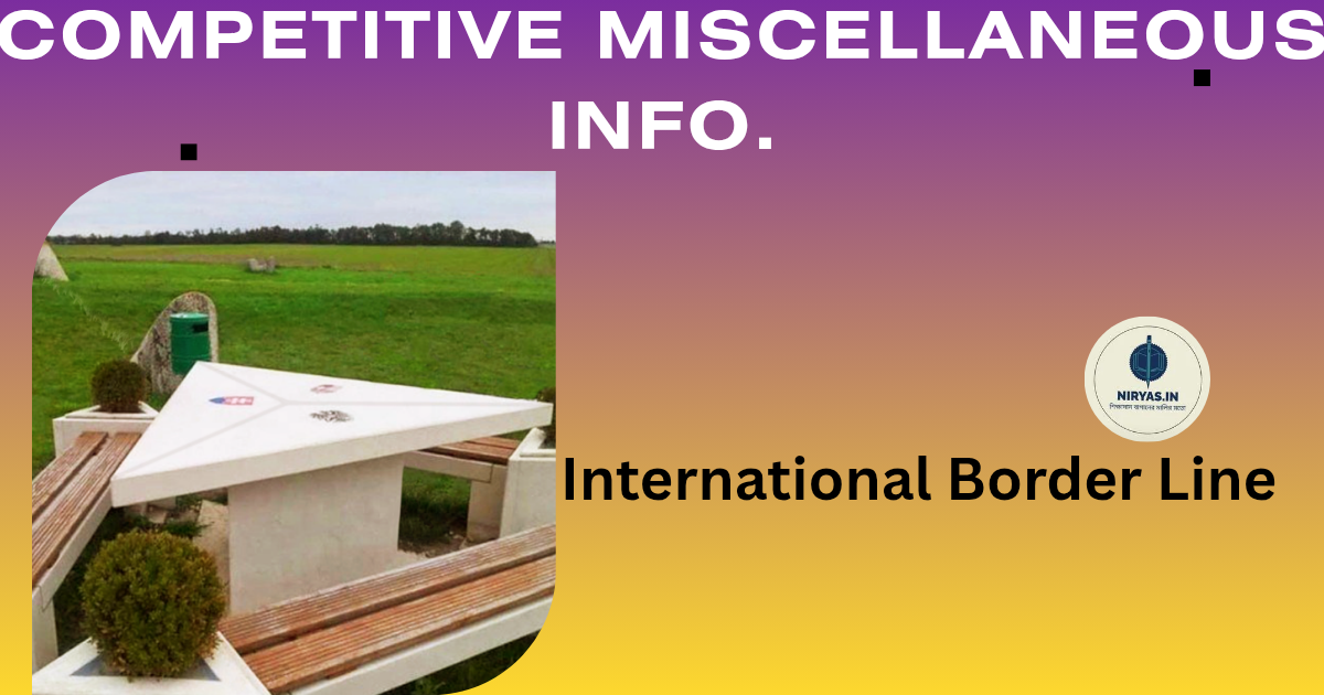
There are four important border posts along the India-Pakistan border line, namely: i) Wagah-Attari border post near Amritsar in Punjab, ii) Hussainiwala-Ganda Singh Wala border post near Ferozepur in Punjab, iii) Sadiqui-Sulemanki border post near Fazilka in Punjab and iv) Munabao-Khokhrapar border post in Barmer district of Rajasthan. Beating Retreat Flag Ceremony is held at these four border posts every evening at 6 pm jointly by the armies of the two countries, which Indian citizens can enjoy while sitting in India without any special permission.
Kartarpur Corridor: The Kartarpur Corridor is a religious corridor that connects the Dera Baba Nanak Gurdwara in Gurdaspur district of Punjab state of India to the west of the Radcliffe Line and the Gurdwara Darbar Sahib in Kartarpur, Narowal district of Punjab province of Pakistan to the west. Through this corridor, Sikhs from India can travel to their holy shrine in Pakistan without a visa.
The corridor was proposed by the then Indian Prime Minister Atal Bihari Vajpayee and Pakistani Prime Minister Nawaz Sharif as part of the Delhi-Lahore bus service diplomacy in early 1999. On 26 November 2018, the current Prime Minister of India, Narendra Damodar Modi, laid the foundation stone of this corridor on the Indian side and on 28 November, the then Prime Minister of Pakistan, Imran Khan, laid the foundation stone of this corridor on the Pakistani side. The corridor was completed on 12 November 2019, the 550th birth anniversary of Guru Nanak, although two days earlier, on 9 November, Indian Prime Minister Narendra Modi and Pakistani Prime Minister Imran Khan inaugurated the corridor in their respective countries. At that time, Captain Amarinder Singh was the Chief Minister of Punjab. According to the then PWD Minister of Punjab, Vijay Inder Singla, the length of this corridor on the Indian side is 4.2 km. The total length of the corridor is 6.3 km. After the inauguration of the corridor, the first batch of pilgrims, comprising 570 pilgrims, visited Gurdwara Darbar Sahib in Kartarpur, including former Indian Prime Minister Manmohan Singh and then Punjab Chief Minister Amarinder Singh.
International Border Line
2. McMohan Line, India-China International Border:
The McMohan Line is an important international border line of India, which was established in 1914, i.e. in British-ruled India, at the Shimla Convention. The line extends for 890 km from the western border of Bhutan along the northern and eastern borders of the North-East Frontier Agency of India, present-day Arunachal Pradesh, to the Izu Razi Pass in present-day independent Myanmar.
This line was established in March 1914 through tripartite negotiations and agreements between China, Tibet and British India. Ivan Chen participated on behalf of China, Lon-Chen Shatra participated on behalf of Tibet, and Lieutenant Colonel Henry McMahon, the then Foreign Secretary of the British Indian Government, participated as the representative of British India. According to this agreement, Henry McMahon divided Tibet, located between China and India, into two regions: Outer Tibet and Inner Tibet. Tibet bordering India is called Outer Tibet, which includes Lhasa, Sighatse, and Chemdo. On the other hand, the part adjacent to the Chinese border is called Inner Tibet, which includes Ba-Tang, Li-Tang, and Taqienlu. That is, when the McMahon line was determined, this line was determined as the border line between Tibet and British India, not directly between China and British India. Until 1951, the McMahon Line was considered the international border between Tibet and independent India. In October 1951, under pressure from China, the Dalai Lama government of Tibet signed the “Seventeen Point Agreement”, indirectly transferring control of Tibet to China. In March 1959, when the Republic of China attacked the Tibetan capital of Lhasa, the then head of the Dalai Lama government and the 14th Dalai Lama, Gyalwa Rinpoche, fled Lhasa on March 17, and the power of Tibet passed to China, and the Indo-Tibetan border, which was established during McMahon’s time, was transformed into the Indo-China border.
Although India initially accepted the McMahon Line as the country’s border and accepted it as the ‘Actual Line of Control (LAC), China rejected it. After the Chinese occupation of Tibet, when the Chinese army started patrolling along the McMahon Line, the Indian government also started patrolling along the border. By 1961, when the Chinese army crossed the McMahon Line and entered Indian territory, the conflict between the Indian and Chinese governments over the McMahon Line came to light, and the McMahon Line’s features gained importance as the India-China border line.
International Border Line
3. Durand Line, International Border of Afghanistan-Pakistan-India: An international border line determined in British India is the Durand Line, which was determined on 12 November 1893 through negotiations between the ruler of Afghanistan, Abdur Rahman Khan, and the Foreign Secretary of British India, Sir Mortimer Durand. Since this line was determined by dividing the Pashtun tribal area into two, there have been problems between Afghanistan and British India at that time and between Afghanistan and British India and now between Afghanistan and Pakistan.
After the independence of British India in 1947, when India and Pakistan emerged as independent countries, the Durand Line stood as the international border of Pakistan-Afghanistan-India. The total length of this border is 2,670 km, most of which is between Pakistan and Afghanistan and only 106 km between India and Afghanistan. Currently, this 106 km is located in Jammu and Kashmir, which was acquired by Pakistan (October 1947). The line touches the Iranian border in the south and the Chinese border in the north.
International Border Line
4. Hindenburg Line: The Hindenburg Line is a defensive artificial border line built along the western border of Germany and the Polish border during World War I in 1917 under the supervision of German Field Marshal Paul von Hindenburg. The need for this line ended after the Treaty of Versailles between Germany and the Axis Powers on June 28, 1919. This line is 140 km long in 20 sections.
5. Mannerheim Line: The Mannerheim Line is an artificial defensive border between Finland and the Soviet Union. Although Finland gained independence in 1917 through the October Revolution in the Soviet Union, this border was formed under the leadership of the Finnish army chief Carl Gustaf Emil Mannerheim due to fear of a Russian attack. The border line was built in two stages between 1920–1924 and 1932–1939. The total length of the border line is about 135 km.
6. 49th Parallel Line: The 49th Parallel Line is the approximately 8,891 km border between the United States and Canada, including Alaska. This line, which defines the border between the two countries, is so named because it follows the 49th degree north latitude. It is also called the Medicine Line.
In addition, the 36th Parallel Line forms the border between the US states of Missouri and Arkansas, the 40th Parallel Line forms the border between the US states of Nebraska and Kansas, the 41st Parallel Line forms the border between the US states of Colorado and Nebraska, and the 42nd Parallel Line forms the border between the US states of Nebraska and South Dakota.
International Border Line
7. Oder-Neisse Line: The border between East Germany and Poland is known as the Oder-Neisse Line. This line was determined in the context of negotiations between the governments of the two countries in 1950 and 1990. The border is so named because it is determined by the 187 km course of the Oder River originating in the Czech Republic and the 197 km long course of the Lusatian Neisse River originating in the Zaire Mountains.
8. 17th Parallel Line: As a result of the First Indochina War, two separate states, North and South Vietnam, began. At the Geneva Conference on July 21, 1945, the border between the two countries was determined parallel to the 17th degree north latitude. The line is so named because the border was determined parallel to the 17th degree north longitude. The length of this border between the two countries is 76.1 km.
9. 20th Parallel Line: A section of the international border between Libya in North Africa and Sudan in Northeast Africa, known as the 20th Parallel, is drawn along the 20th degree north latitude. This border is 105 km long.
International Border Line
10. 35th Parallel Line: The border between Tennessee and North Carolina, which is located in the south and Georgia in the north, and extends parallel to the 35th degree north latitude from Ellicott’s Rock in the east to Nickajack in the west. This border, 177 km long, was permanently drawn in 1826.
11. 36°30′th Parallel Line: The natural boundary between the states of Missouri and Arkansas, Tennessee and Kentucky, Oklahoma and Texas, and Virginia and North Carolina, in the United States, which is determined by following the 36°30′ north latitude.
12. 37th Parallel Line: The boundary between six states of the United States, which is determined by following the 38° north longitude. Of these six states, the three states located to the north are Utah, Colorado, and Kansas from west to east, and the three states located to the south are Arizona, New Mexico, and Oklahoma from west to east. This boundary was determined in 1854.
13. 38th Parallel Line: The common border between North Korea and South Korea is called the 38th Parallel Line. After World War II, a plan was made to divide Korea based on US and Soviet domination of the Korean peninsula. To implement this plan, two US military chiefs named Charles Bonesteel and Dean Rusk met on August 10, 1945 and studied the National Geographic Map and found that the 38th parallel had extended to bisect Korea. On August 14, they presented the 38th parallel as the dividing line of the Korean peninsula, which the Soviet Union accepted and the 38th parallel was established as the border line between North and South Korea. This line is not currently recognized, but rather the 250 km long Military Demarcation Line (MDL), north of and approximately parallel to the 38th parallel, is considered the border line between North Korea and South Korea, according to the Korean Armistice Agreement signed between the United States, North Korea, and China on July 27, 1953. ➣ বাংলায় পড়ুন ➣ Read in Hindi
International Border Line International Border Line
#Source:
1. “Reading like a Historian” : Stanford History Education Group
2. “Lahore Resolution” : Wikipedia
3. “The Sole Spokesman: Jinnah, the Muslim League and the Demand for Pakistan” : Ayesha Jalal
4. “Presidential address by Muhammad Ali Jinnah to the Muslim League
Lahore, 1940” : link : http://www.columbia.edu/itc/mealac/pritchett/00islamlinks/txt_jinnah_lahore_1940.html International Border Line
5. “Jinnah – Gandhi Talks (1944)” : https://historypak.com/jinnah-gandhi-talks-1944/
6.”Borderline, Peacock at Sunset” : Franc Jacobs International Border Line
7. “The McMohan Line” : E. Bruke Inlow
8. “Truth About McMahon Line” : J.P Mitter International Border Line
9. “Annexation of Tibet by the People’s Republic of China” :
10. “Sino-Indian War” : Wikipedia
11. “A Selection of Historical Maps of Afghanistan” : Cynthia Smith
12. “Durand Line”: Wikipedia
13. “The history of the Mannerheim Line” : Sami Korhanen
14. “Libya–Sudan border” : Wikipedia
15. “How Georgia got its northern boundary – and why we can’t get water from the Tennessee River” :
Jamil Zainaldin
16. “Korean Demilitarized Zone” : Wikipedia
Discover more from NIRYAS.IN
Subscribe to get the latest posts sent to your email.


